
SHAPE
South Stratford Housing & Planning for Everyone
Evidence
Transport
Transport is one of the key issues raised by many residents during the Regulation 19 consultation. This page summarises the main findings from SHAPE's review of the Council's own transport evidence.
At a glance
The Council's own evidence suggests that the proposed scale of development would place significant pressure on Stratford's road network. Even after including major mitigation, including the proposed South Western Relief Road, traffic modelling indicates that congestion would remain at many important junctions.
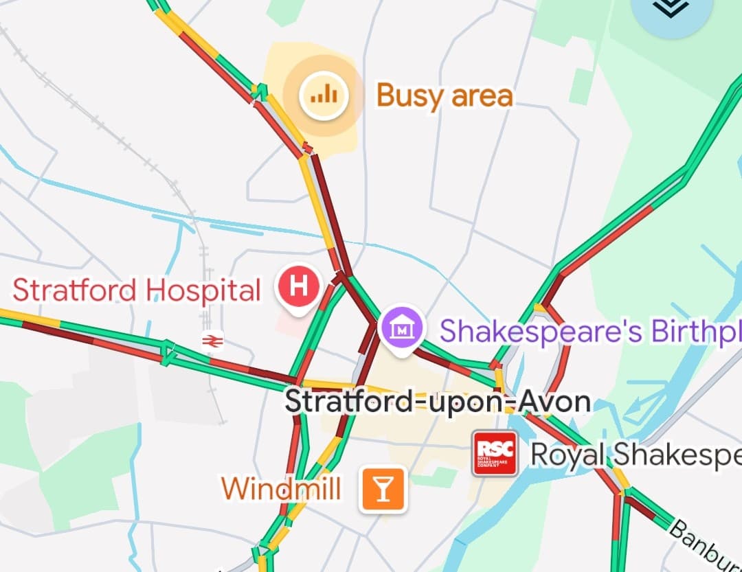

1. Even with major road improvements, congestion remains
The Council tested whether the proposed developments could be supported by introducing a package of major transport improvements, including the proposed South Western Relief Road (SWRR) and extensive upgrades to key junctions across Stratford.
While these measures improve traffic flow in some locations, the Council's own modelling shows that congestion remains above the Reference Case across the network. At some junctions, significant queues persist and further redesign work is acknowledged as being necessary.
Key finding
Even after assuming delivery of the South Western Relief Road and numerous highway improvements, the Council's own evidence indicates that parts of the road network would continue to experience higher levels of congestion than the Reference Case.
In other words, even after assuming hundreds of millions of pounds of highway investment—including the South Western Relief Road—the Council's preferred strategy still performs worse than the scenario without the proposed development.
Potential NPPF concerns
Paragraph 116 – Severe transport impacts
National planning policy requires Local Plans to ensure that severe transport impacts are appropriately addressed. Although the Council's proposed mitigation package improves conditions in some locations, its own modelling indicates that congestion remains above the Reference Case across parts of the network and that some junctions require further design work. This raises questions about whether the proposed mitigation fully addresses the cumulative transport impacts of the planned development.
Paragraph 36(c) – Effective infrastructure delivery
Local Plans should identify the infrastructure required to support development and explain how it will be delivered. Where the Council's own evidence indicates that congestion remains even after assuming the delivery of the South Western Relief Road and extensive junction improvements, there may be questions about whether the proposed infrastructure is sufficient to support the scale of growth planned.
Paragraph 36(b) – Justified
A Local Plan should be supported by proportionate and robust evidence. If the preferred strategy still results in materially worse network performance despite major mitigation, the evidence should clearly demonstrate why this represents the most appropriate strategy when compared with reasonable alternatives.
2. The Local Plan depends on major infrastructure that has not yet been secured
The Council's transport strategy relies heavily on the proposed South Western Relief Road (SWRR) to support several of the largest housing allocations, including South Stratford (STR.2), Long Marston Airfield (LMA) and Bidford (BID.1).
The Council's own transport modelling indicates that without the Relief Road, traffic conditions would deteriorate significantly, with much longer journey times, severe congestion and some model simulations unable to clear traffic during peak periods. The Relief Road therefore forms a fundamental part of the Local Plan's transport strategy.
Key finding
The South Western Relief Road is central to the Local Plan, yet there is currently no committed funding package for its delivery. The scheme also depends upon further technical work, statutory approvals and future investment decisions before construction could begin.
In other words, the Local Plan assumes delivery of infrastructure that the Council itself acknowledges still requires substantial funding, design, approvals and implementation before it can become operational.
Before the road could be built, it would still need to:
- Secure a committed funding package.
- Develop a detailed business case.
- Complete further transport modelling and technical design.
- Undertake environmental assessment and obtain statutory approvals.
- Acquire land where required.
- Procure contractors and construct the road.
Estimated cost
Independent estimates prepared for the Council suggest the South Western Relief Road could cost between:
£170 million – £630 million
depending on the final design, scope and opening date.
Potential NPPF concerns
Paragraph 36(c) – Effective infrastructure delivery
Local Plans should identify the infrastructure needed to support development and explain how, when and by whom it will be delivered. As the South Western Relief Road is fundamental to the Council's preferred strategy, but currently has no committed funding package and requires substantial further work before construction can begin, there may be questions about whether its delivery has been demonstrated with sufficient certainty.
Paragraph 36(b) – Justified
A Local Plan should be supported by proportionate and robust evidence. Where a key piece of infrastructure is essential to the success of the strategy, the evidence should clearly demonstrate that delivery assumptions are realistic and achievable within the Plan period.
Paragraph 116 – Severe transport impacts
The Council's own modelling indicates that, without the South Western Relief Road, the proposed level of development would result in severe impacts on the highway network. This places particular importance on demonstrating that the road can be delivered in time to support the planned growth.
Who ultimately pays for the Relief Road?
The proposed South Western Relief Road could cost hundreds of millions of pounds. But how would it actually be funded, and what financial risks could fall on the new South Warwickshire Council?
Read: The South Warwickshire Local Plan – Bridges & Loans →3. Around 2,400 homes are planned before the South Western Relief Road is expected to open
The Council's Housing Trajectory shows that substantial development is planned across the Stratford area before the South Western Relief Road (SWRR) is expected to become operational.
Across the developments most likely to affect Stratford—Long Marston Airfield (LMA), Stratford South-east (STR.2), Stratford North (STR.1), Stratford West (STR.3), Bidford-on-Avon (BID.1) and Wellesbourne North (WEL.1)—the Council plans for approximately 2,400 homes to be completed before 2035/36.
Key finding
Around 2,400 homes are expected to be occupied before the South Western Relief Road is anticipated to open, despite the Council's own transport modelling indicating that development without the Relief Road results in severe impacts on the highway network.
This is consistent with the Council's Delivery Strategy, which explains that development itself will help fund and enable delivery of the Relief Road. Rather than requiring the road to be completed first, the proposed housing is expected to contribute towards making the scheme deliverable.
Importantly, the Council has already assessed what happens if development proceeds without the South Western Relief Road. That assessment predicts substantially increased congestion, much longer journey times and severe impacts across parts of the highway network.
Potential NPPF concerns
Paragraph 116 – Severe transport impacts
The Council's own transport modelling concludes that development without the South Western Relief Road would result in severe impacts on the highway network. However, the Housing Trajectory indicates that around 2,400 homes are expected to be occupied before the Relief Road is anticipated to open.
We have not identified published evidence demonstrating that this level of phased development can be accommodated without those severe impacts occurring. This appears to represent an important evidence gap between the transport assessment and the proposed delivery strategy.
Paragraph 36(c) – Effective infrastructure delivery
National planning policy expects the infrastructure needed to support development to be planned alongside that development. The Housing Trajectory instead indicates that thousands of homes are expected to be occupied before the South Western Relief Road is operational, raising questions about whether the necessary transport infrastructure is being delivered at the appropriate time.
Paragraph 36(b) – Justified
A Local Plan should be supported by proportionate evidence. Given that the Council's own modelling identifies severe impacts without the Relief Road, it would be reasonable to expect evidence demonstrating that the planned phased occupation before the road opens can occur without unacceptable impacts on the transport network. We have not found such evidence within the published transport documents.
4. The transport forecasts rely on ambitious assumptions
The Council's transport model assumes that many people will choose buses, walking and cycling instead of travelling by car. These assumptions reduce the number of future car journeys within the model and therefore reduce the amount of predicted congestion.
Key finding
The modelling assumes substantial increases in bus use, walking and cycling, but it is not clear whether the infrastructure, service levels and long-term funding needed to achieve these changes have been secured.
Ambitious assumptions about public transport
The modelling assumes that bus patronage can more than double, returning to levels last seen before passenger numbers declined. It also assumes that a significant proportion of existing car journeys will transfer to improved bus services.
However, the published evidence does not identify committed operator agreements or long-term funding that would guarantee these service levels throughout the lifetime of the Local Plan.
Walking and cycling routes may also be affected
The Council also expects more journeys to be made on foot and by bicycle. At the same time, several proposed highway schemes would cross existing walking and cycling routes, including sections of the Stratford Greenway and Public Rights of Way.
The published evidence does not clearly explain how these routes will remain safe, attractive and convenient once the strategic highway schemes are built, or whether any reduction in their attractiveness has been reflected within the transport modelling.
In other words, the predicted traffic levels depend partly on people changing how they travel. If those behavioural changes are not achieved, traffic levels could be higher than those forecast by the model.
Potential NPPF concerns
Paragraph 36(b) – Justified
A Local Plan should be supported by proportionate and robust evidence. Where transport forecasts rely upon significant changes in travel behaviour, the evidence should demonstrate that these assumptions are realistic and achievable, or explain how the strategy would perform if they are only partially realised.
Paragraph 116 – Severe transport impacts
If fewer people switch from private cars to buses, walking or cycling than assumed, traffic levels could be higher than forecast. This may affect whether the cumulative transport impacts of the proposed development remain acceptable.
Paragraph 104 – Promoting sustainable transport
National planning policy encourages opportunities to promote walking, cycling and public transport. Where major highway infrastructure affects existing active travel routes, it is important that these routes remain safe, attractive and convenient if the expected shift away from private car use is to be achieved.
5. Does the modelling reflect Stratford's busiest days?
The transport model used to assess the Local Plan is based on "neutral weekday" traffic conditions, using travel data collected during typical Tuesdays, Wednesdays and Thursdays. This follows standard transport modelling practice by representing an average weekday rather than periods of unusually high demand.
Key finding
While the modelling is based on neutral weekday conditions, it is not clear whether the published evidence has tested how Stratford's road network would perform during predictable periods of much higher demand, such as weekends, bank holidays and the peak tourist season.
Stratford experiences unique traffic patterns
Unlike many towns, Stratford-upon-Avon attracts millions of visitors each year. Traffic levels during weekends, holidays and major events can be substantially higher than on a typical weekday, with additional congestion around the town centre, Clopton Bridge, Bridge Foot, the River Avon and key routes into the town.
These periods also see much greater pedestrian activity, increasing demand at crossings and affecting how traffic moves through the town centre.
Tourism continues to grow
Tourism data published by Shakespeare's England indicates that visitor numbers have continued to increase since the transport model was developed. This suggests that seasonal demand on Stratford's road network may now be greater than the baseline represented within the transport model.
In other words, the modelling demonstrates how the network is expected to perform on an average weekday. It is less clear from the published evidence whether the same conclusions apply during the periods when Stratford's road network experiences its greatest demand.
Potential NPPF concerns
Paragraph 36(b) – Justified
A Local Plan should be supported by proportionate and robust evidence. Given Stratford's significant visitor economy, it may be reasonable to expect the evidence to explain whether the proposed strategy remains acceptable during foreseeable periods of substantially higher traffic demand, rather than only under average weekday conditions.
Paragraph 116 – Severe transport impacts
If traffic conditions during weekends, holidays and peak tourist periods are materially worse than those represented in the transport model, there may be questions about whether the cumulative impacts of development have been fully assessed under the conditions residents and visitors regularly experience.
6. Have neighbouring developments been included?
Thousands of new homes are also proposed just outside South Warwickshire, particularly within neighbouring Cotswold District. Many residents of these communities already travel to Stratford for work, shopping, education and leisure, placing additional demand on the town's roads.
Key finding
It is not clear from the published transport evidence whether significant planned growth in neighbouring authorities, particularly Cotswold District, has been fully reflected within the modelling or tested through sensitivity analysis.
Stratford serves a much wider area
Stratford-upon-Avon is the main employment, shopping and service centre for many nearby communities beyond the district boundary. Regular journeys are made between places such as Mickleton, Chipping Campden and Moreton-in-Marsh using routes including the A429, A3400 and B4632.
Thousands more homes are planned nearby
The emerging Cotswold Local Plan proposes substantial additional housing, including approximately:
- 589 homes in Mickleton.
- 2,135 homes in Moreton-in-Marsh.
- 228 homes in Chipping Campden.
Much of this additional traffic is likely to use Stratford's road network, particularly routes approaching the town from the south.
The published evidence acknowledges limitations
The Council's transport consultants acknowledge that their assessment is high-level and that future traffic growth from additional developments has not been fully represented. However, the published evidence does not clearly explain whether emerging growth in neighbouring Cotswold District has been incorporated within the background traffic forecasts or assessed through separate sensitivity testing.
In other words, it is difficult for readers to determine whether the cumulative impact of planned development across administrative boundaries has been fully assessed before concluding that the proposed transport strategy is acceptable.
Potential NPPF concerns
Paragraph 36(b) – Justified
A Local Plan should be supported by proportionate and robust evidence. Where significant housing growth is proposed in neighbouring authorities and is likely to affect Stratford's road network, the evidence should clearly explain how those cumulative impacts have been taken into account.
Paragraph 116 – Severe transport impacts
If additional cross-boundary traffic has not been fully reflected within the transport assessment, future traffic levels and the cumulative impacts of development could be underestimated.
Paragraph 27 – Strategic cross-boundary matters
National planning policy expects strategic planning authorities to address cross-boundary issues where development in one area is likely to affect another. Clear evidence explaining how neighbouring growth has been considered is therefore an important part of demonstrating that the Local Plan has taken account of wider strategic impacts.
Would you like to add this evidence to your Regulation 19 submission?
We've prepared a PDF version of this page that you can download and include with your Regulation 19 submission.
Download this page as a PDFRead the full technical review
This page summarises the main findings. Our complete technical review contains detailed references, planning policy analysis and supporting evidence. Please note that some site references have since been renamed in the South Warwickshire Local Plan. The current references are: SG19 → STR.2, SG18 → STR.3, SG20 → BID.1, SG15 → WEL.1 and New Settlement E1 → LMA (Long Marston Airfield). Please also note that, since this report was written, a subsequent review of the Council's published housing trajectory has shown that substantial numbers of homes are planned to be occupied before the South Western Relief Road (SWRR) is expected to be operational.
Download the full report (PDF)